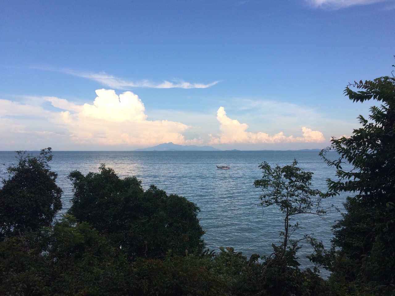
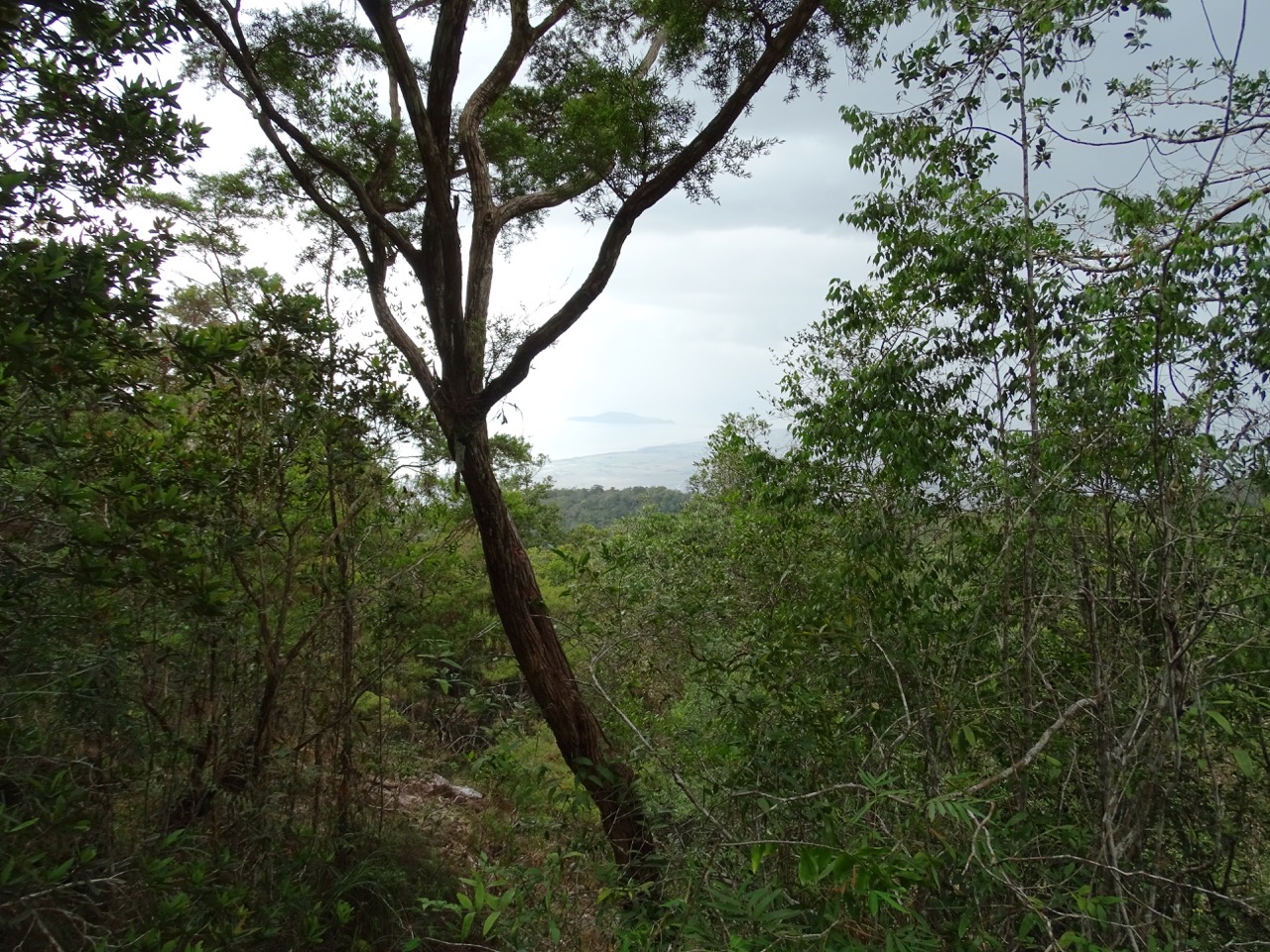
Look, there is an island over there. No, it can’t be, that’s the mainland.
Mount Jerai – a mountain lost in paddy fields
For an unsuspecting onlooker from Penang island, Gunung Jerai (aka Mount Jerai) is confusing. The land surrounding it is famous for paddy fields, i.e., low and flat. The mountain in the middle looks like it got stuck while heading somewhere millions of years ago and never bothered to leave.
Couple times we almost went there, but something always got in a way. A thunderstorm, bad traffic on a bridge, not wanting to wake up too early on the weekend…
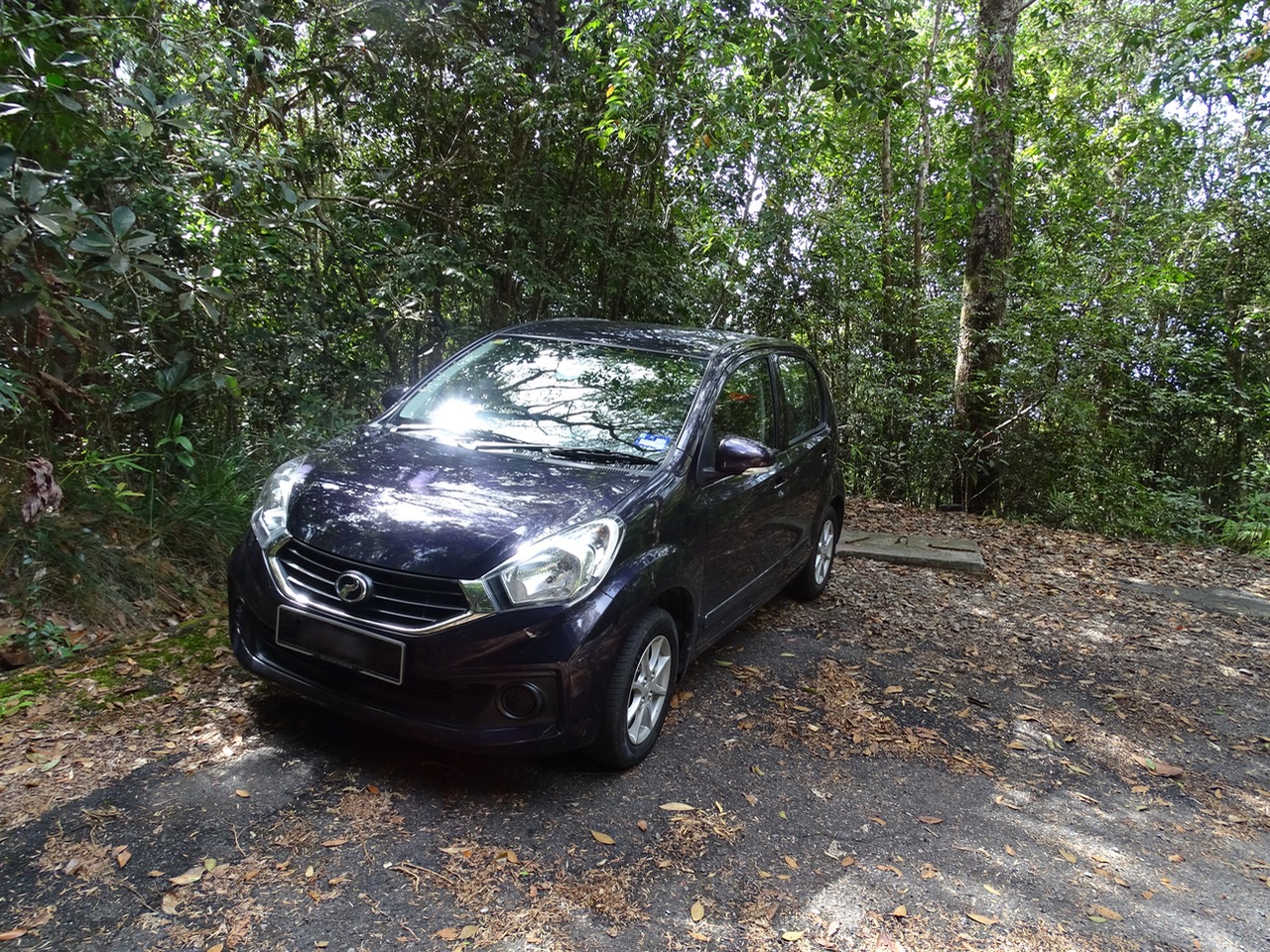
Finally, driving back from Ipoh to Penang, on a whim we decided to visit Gunung Jerai. With more than half a day left, it should be an easy trip following Google Maps directions.
A wrong turn led to scary drive up. An omnipresent rain-cum-thunderstorm caused terrifying drive down.
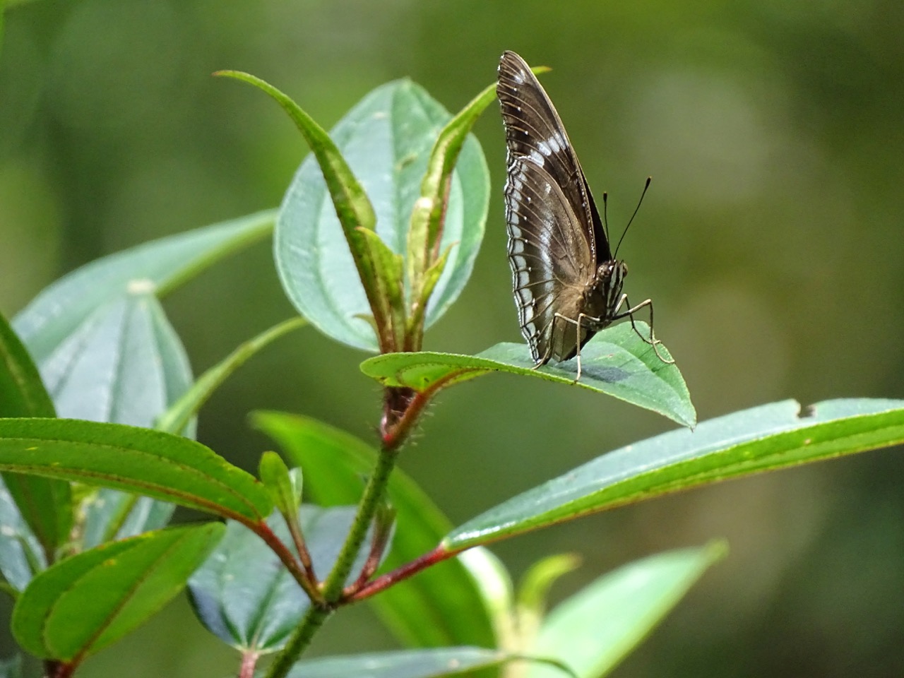
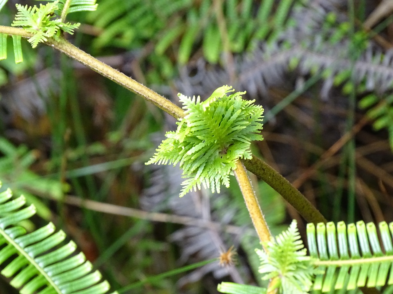
In-between, it was a remarkable combination of delightful, albeit cut short by a sudden downpour, hike, discovery of mysterious landmark and a close encounter with Malaysian flora and fauna.
It was one of these spontaneous adventures that you never forget but wouldn’t want to repeat.
Geography, history and Kedah lore
Mount Jerai formative years
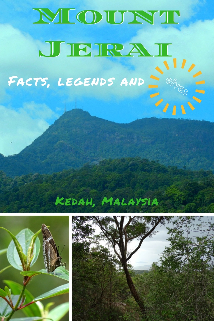
Formerly known as Kedah Peak, Mount Jerai is a dramatic forest-covered limestone outcrop rising approximately 1200 meters(3,937 feet) above sea level.
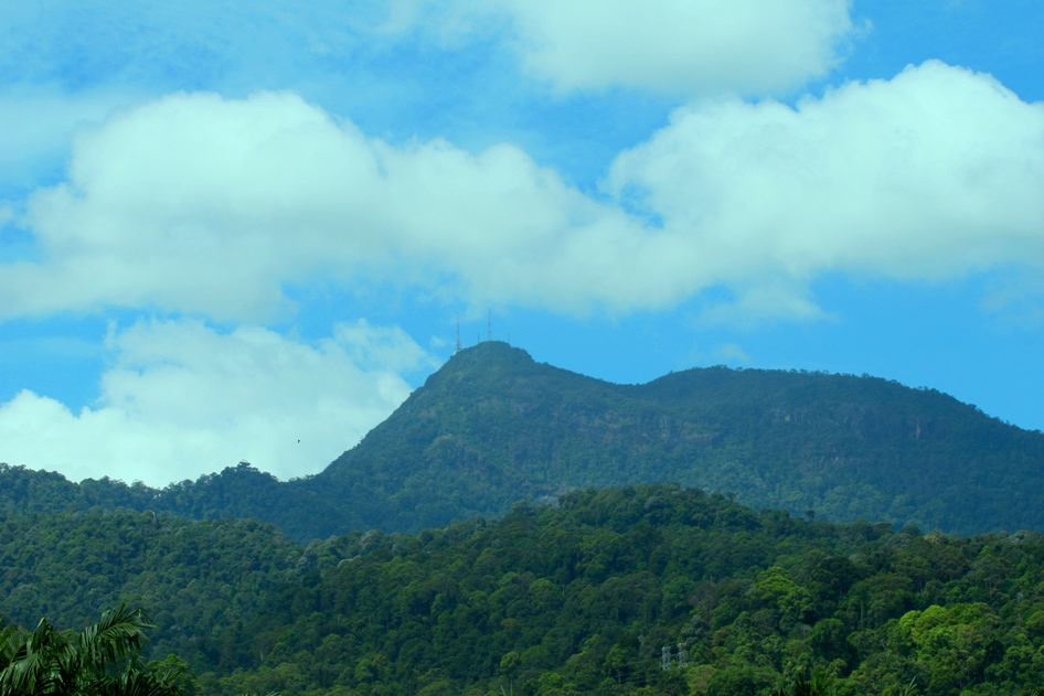
Different sources list its height somewhere between 1,175 and 1,217 meters. It is tall enough to be visible from Malacca Straight.
According to the information board at the top of the mountain, Gunung Jerai used to be an island before the sea levels receded transforming it into a mountain. Been the highest point in the area, Gunung Jerai adds some variety to monotonous flat surroundings.
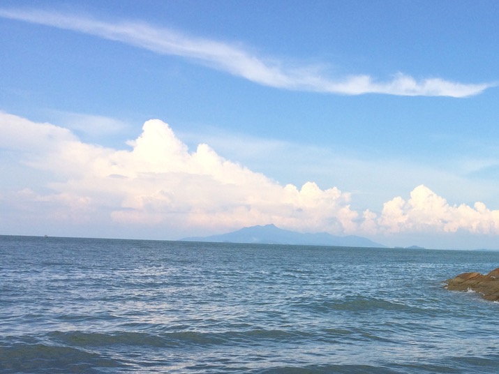
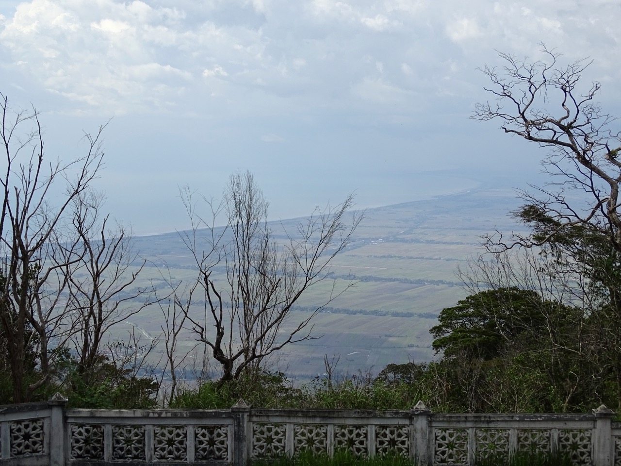
On clear days, the mountain offers spectacular panoramic views of the “rice bowl” of Malaysia and turquoise waters of Andaman Sea. The air is cooler at the top making Gunung Jerai hiking even more pleasant.
Spicy Gunung Jerai
Gunung Jerai played a significant role in the history of the Spice Routes. The port in Bujang Valley, situated between Mount Jerai and Muda River, was the first of its kind in Southeast Asia. It connected the East and the West and was a preferred route for many merchants in the spice trade.
As far as 1500 years ago, the strategically located Gunung Jerai was the first point of reference for Indian and Arab seafarers coming from the Bay of Bengal. They traded and eventually settled at the foothills. Considering the mountain to be sacred, they built a complex of temples that have been excavated and preserved at the Lembah Bujang Archeological Museum site.
Legends of Gunung Jerai forest
And, of course, there is a fair share of legends passed from generation to generation by local historians. According to them, mountain forest is home to orang bunian (magical creatures similar to elves except they are invisible to most humans), and people have gone missing there!
The bloodiest tale is about Raja Bersiong, the Fanged King. He was the ruthless ruler of an ancient kingdom at the foot of the mountain. He had a penchant for consuming human blood and, somewhat unexpectedly, spinach broth.
This vampire-like character even has a Facebook page dedicated to collecting various versions of the Fanged King legend.

Raja Bersiong was the actual historical figure not a figment of the wild imagination. Recent archeological excavations uncovered the existence of the Temple of the Ninth Water Pool.
Allegedly, this pool was the private pool of the Fanged King. Sometimes, it’s hard to separate fact from fiction, so who knows it might be true.
Our misadventure
Gunung Jerai hiking is not for faint-hearted. Only brave souls would succeed.
Up and up we went and stopped in front of the sign.
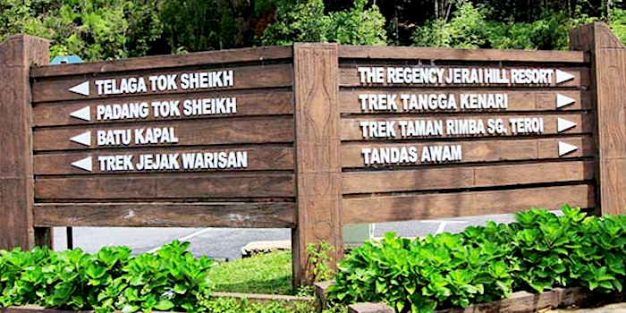
The sensible way was turning right and go toward the Regency Jerai Hill Resort. This is the route recommended by every tourist brochure, guide book or website.
Google Maps programmed to show directions to the top of the mountain demanded to turn left. Guess which way we went.
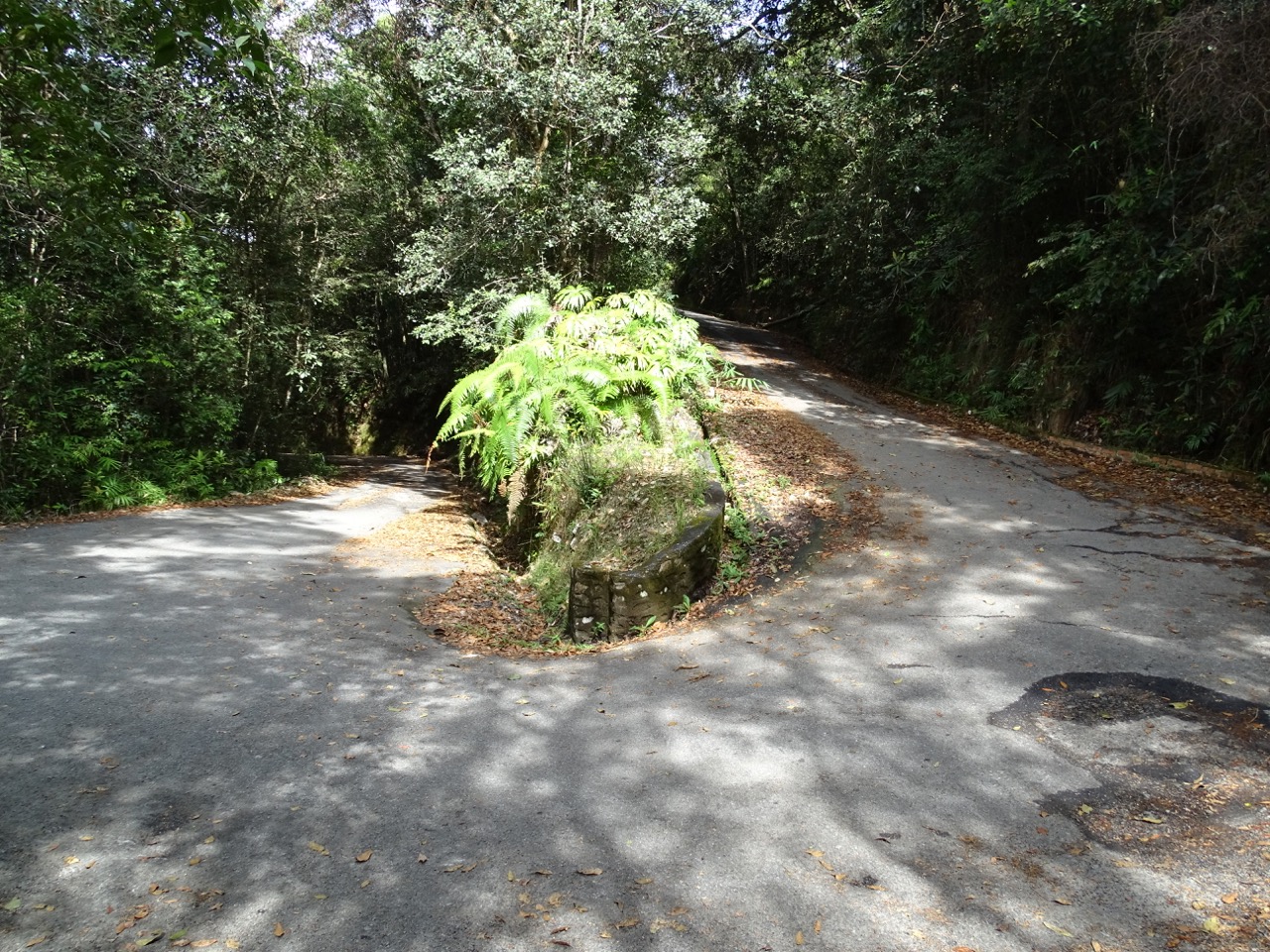
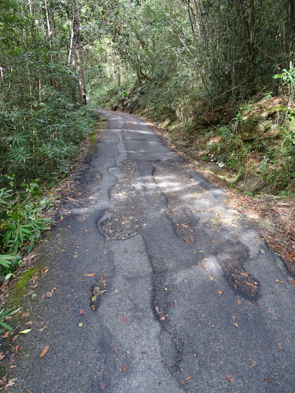
We quickly drove through an unknown homestay and an eco farm. The road suddenly became so narrow that we couldn’t turn back even if we wanted. Its surface was the testament to never ending fight between the elements and humans with the former been an undisputed winner.
With an almost vertical tree-covered drop on one side and its identical evil twin brother on the other, a serpentine lane was relentlessly twisting and climbing.
What if another car would be coming down? This unwelcome thought was hanging in the air. Finally, at a sight of somewhat wider turn, I lamely squeaked “Park, please!”
Google Maps showed that there were still about 4km left to the dot they considered the mountain top.
Legs vs. wheels
A car passed, then a scooter. It was a reassuring sign.
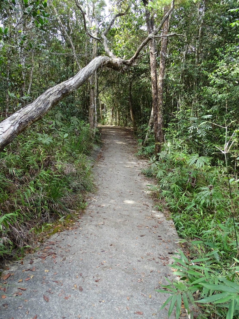
The hike was a welcome change of pace. The air was slightly colder, and light wind made it even more pleasant.
The trees became more rugged. Even though they were shorter and not as dense up there in comparison to the valley, there were just a few spots with more or less unobstructed views.
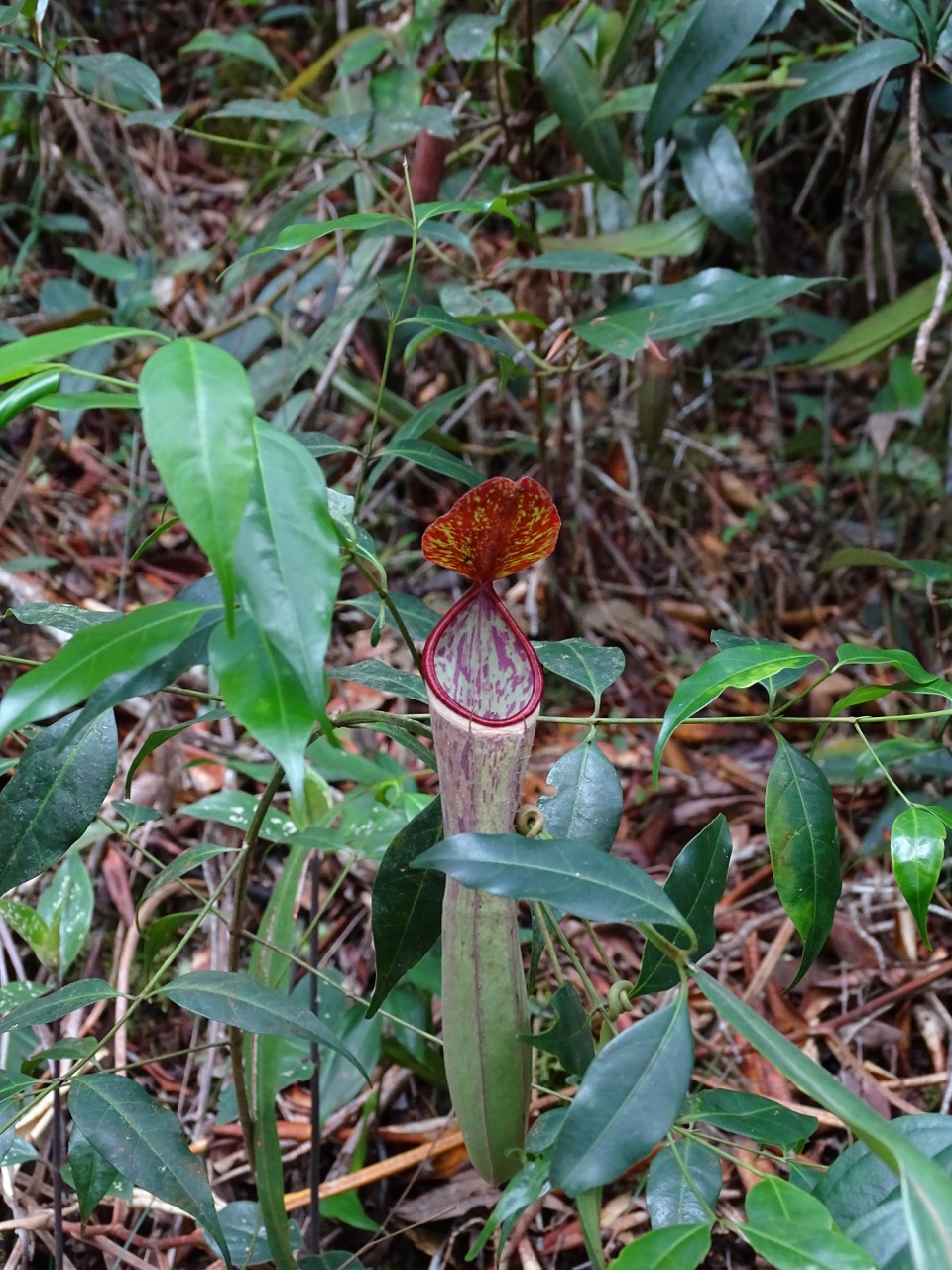
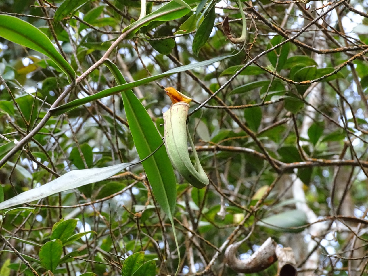
So far, we haven’t seen monkey cups in the wild. They have to love Mount Jerai since there were plenty of them there.
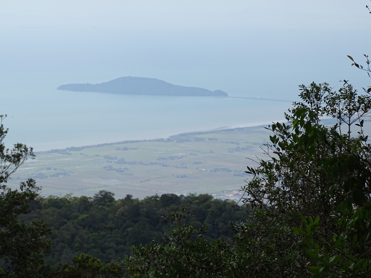
We passed the point that Google marked as the top of the mountain. The road proceeds further, and we followed. A little bit further, we came to an improvised parking.
Some voices were coming from the woods. Curious, we followed the path…
…and the stairs…
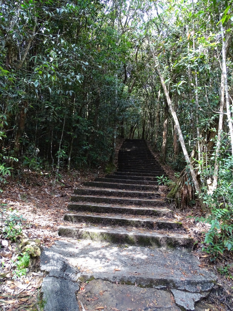
…and entered an uncommon place.
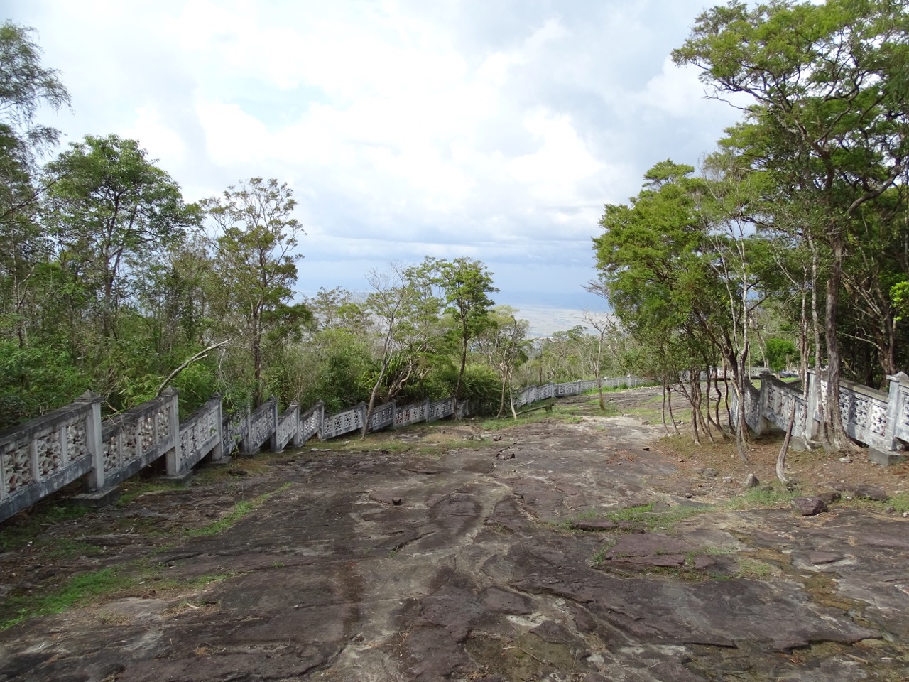
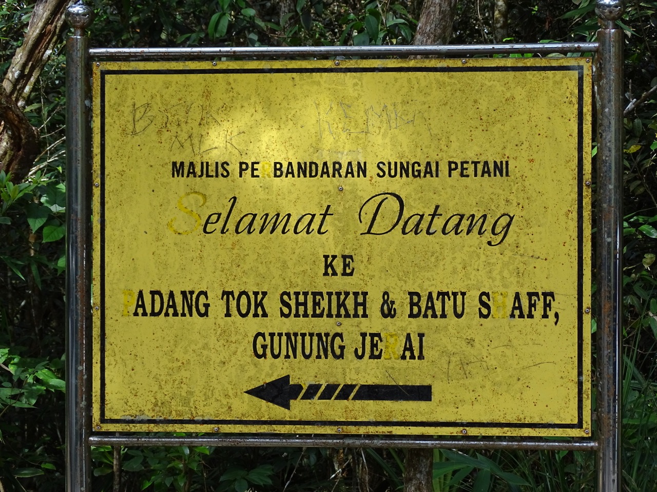
Padang Tok Sheikh
Padang Tok Sheikh loosely translates into English as the Elder’s Field. The story of this place goes back to times when the region was converted from Hinduism to Islam.
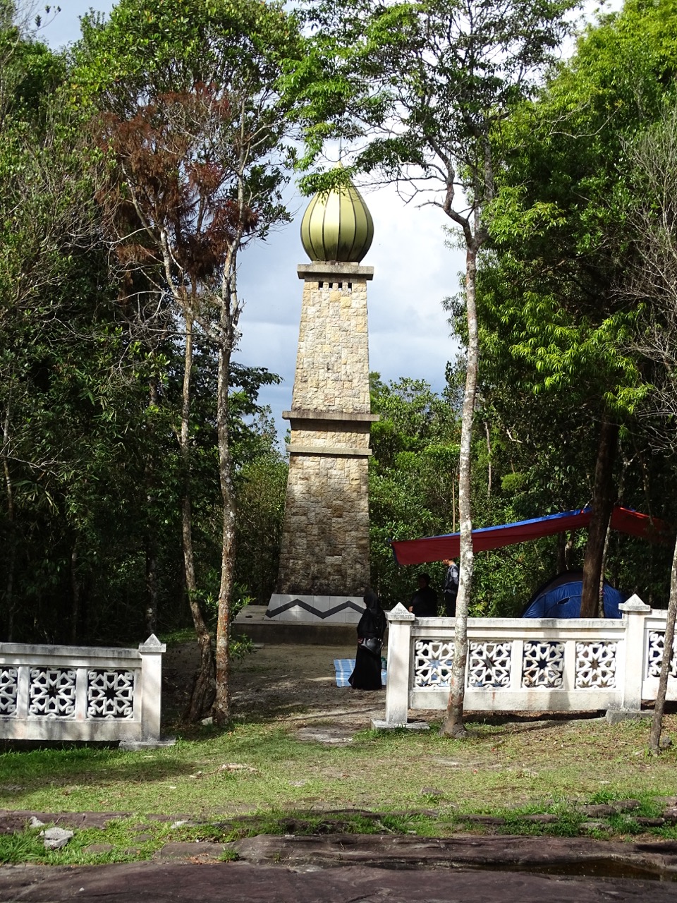
In 1136 Sheikh Abdullah, a Muslim scholar from Yemen, visited the Kedah Kingdom and met their king. The audience resulted in the king’s conversion to Islam and establishment of the Sultanate of Kedah. The newly minted sultan held Sheikh Abdullah in high regard for his sincerity, wisdom, and modesty, and appointed him as the personal adviser.
According to the legend, the Sultan asked Sheikh Abdullah how to leave the lasting memory for coming generations. The elder recommended building a tower at the peak of Gunung Jerai that would commemorate the ruler’s conversion into Islam and would be used as a place for prayer. Sheikh Abdullah was appointed to supervise the construction process. When the tower was nearing completion, he fell ill and died soon after.
Sheikh Abdullah was buried in the field near his last unfinished project. The land around his burial site became known as Padang Tok Sheikh (aka the Elder’s Field).
Nowadays, the flat rocky surface is guarded by the white fence. Locals bring families or come by themselves to quietly contemplate the nature. A few people were sitting or lying on the rocks admiring sweeping views of the land below.
Down we go
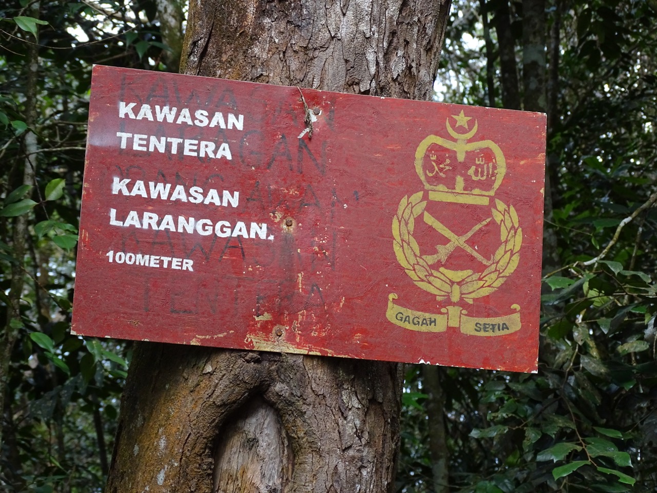
Back to the parking, we had two choices: return to the car or continue the climb. There are two antennas at the top of the mountain.
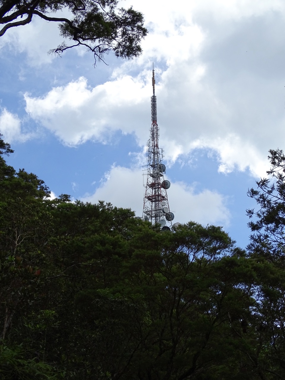
Anecdotally, the views are amazing from there. However, at least one of antennas belongs to Malaysian military. According to locals, it’s better not to ruffle their feathers and stay away from restricted areas.
Capricious Gunung Jerai
The notoriously unpredictable weather decided that it gave us enough time to enjoy the mountain. Thick clouds gathered together surprisingly quickly. By the time we got back to the car, first huge drops of rain had started to pound the road.
We sprinted last 50 meters to the car before skies opened letting lose torrential downpour. Not wanting to get stuck on the mountain in the dark, we decided to leave.
The trip down to the valley was nightmarish. At times, rain was so heavy that vipers were useless. The only good thing was the fact that the road was properly maintained and water was running off the surface creating ferocious streams on both sides, but mercifully left the middle part drivable.
I have to say that I was the happiest person on Earth when we left Mount Jerai. Obviously, just a couple kilometers off the mountain there was no rain in sight.
How to get the most out of your visit to Gunung Jerai
• If you just want to visit Mount Jerai’s most famous sites
Timothy Tye started to write about Penang in 2003. Since then, his website grew into a one-stop-shop of all things Penang and beyond. It has a section related to Mount Jerai with maps and directions how to get there.
Unfortunately, the website is littered with ads making it hard[er] to browse. On the bright side, been local helps him to provide more accurate and comprehensive information. Also, you might want to read about Sungai Teroi Recreational Forest since it is located on the mountain and definitely worth a visit.
• If you are off-the-bitten-path type of traveler
Take the left turn at the crossroads as we did. What could be better than a day in tropical paradise? Just keep a camera ready because regardless of your photo proficiency level you wouldn’t be able to stop snapping pictures.
The road is paved, so comfortable sandals of flip-flops would be okay.
Bring plenty of water. Even though it is slightly colder higher you climb, it is still pretty warm and humid.
Do not forget a snack or even lunch. Padang Tok Sheikh would be the perfect place to take a break, get a bite, catch some sun if you are lucky. Speaking of which, beware of the weather. It changes quicker than you can snap fingers. It will rain at some point. Just take it for granted and enjoy your outing.
I would highly recommend to park your car at the crossroads and proceed on foot.
The distance is misleading. The climb is quite steep for the most part. Conservatively, taking into consideration pauses to take pictures, it would take about couple hours to reach your destination. On the way back, it would take bout an hour.
• Fancy a Gunung Jerai hike?
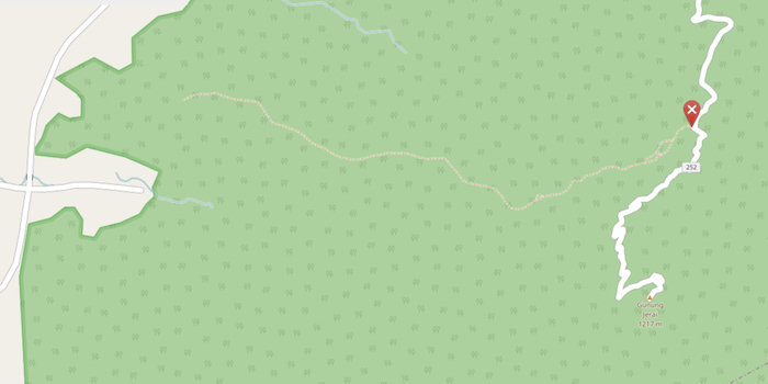
There is a trail that begins at the serpentine road and snakes through the forest all the way to Lembah Bujang Archaeological Museum. To find it, follow off-the-bitten-path directions above. At the sharp left turn about two thirds of the way up to Padang Tok Sheikh, you will see a weathered sign on the right side of the road.
That’s it – you reached the trail entrance.
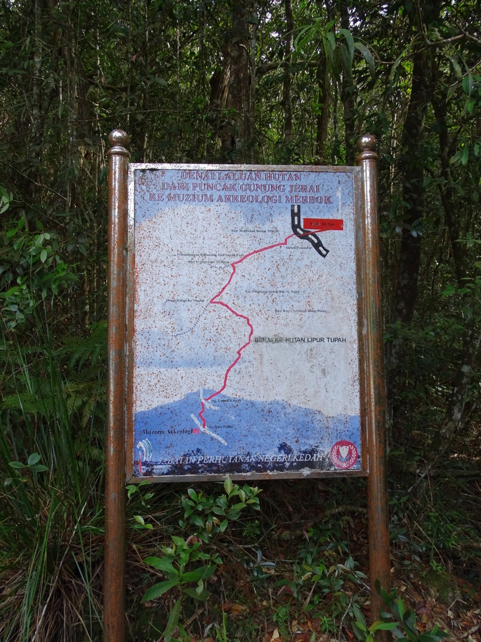
Two important notes:
- you need hiking shoes to go through the forest
- Google maps do not know about Gunung Jerai hiking trail. Openstreetmap.org knows about it but shows a very rough map of the area. Treat their map as a suggestion not as real thing.
• If you are a history buff
For years, it was commonly believed that Malay civilization only began during the Malacca Sultanate some 400 years ago. Recent archeological findings in Bujang Valley proved it wrong.
Sungai Batu Archaeological Complex is home to the oldest civilization in Southeast Asia where the remains of the earliest human-built structures have been found dating back some 2000+ years.
- Malaysia’s Sungai Batu Among Oldest Southeast Asian Civilizations from BeharNews
- World archaeological experts fascinated by Sungai Batu ancient site from Malay Mail Online
Places to visit:
Sungai Batu Archeological Site
Address: Kampung Permatang Samak, 08100 Bedong, Kedah, Malaysia
Lembah Bujang Archaeological Museum
Address: 08400 Merbok, Kedah, Malaysia
You might also like:
- Entomological Utopia
- Penang Where Cows Roam Free
- Where is that perfect lantern pic?
- Kuala Lumpur Photo Essay
- Grenoble Olympics Through The Lens Of Time
- Discovering The Real Costa Rica
Published: March 2017. Last update: September 2019
Share this article on Pinterest by clicking Save button
This sounds like a great adventure. I can relate to your mix of wow factor and fear – something I am familiar with from our own adventures.
Thank you, Lyn 🙂
Great post and really interesting! I love reading about places I’ve never heard of! Really good photos too!
Thank you, Jamie. Happy that you liked the post and the photos 🙂
How gorgeous Elena! Penang had such a mysterious feel to it; from the melting pot culture, to the quiet, chill, peaceful jungle. I loved walking around a national park on the island. Humidity about 40 billion percent LOL but so worth it!
Thank you, Ryan. The island is so beautiful that extra sweating while exploring it is a small price to pay 🙂
Excellent write up! It’s so refreshing to read off-the-beaten-path in Malaysia from a ‘westerner’s’ perspective. May I ask, where your rented your car? (I tried to go by taxi once.. and that was a fail) 😀
Hi, Vanessa. Thank you very much for your kind words :). About the rental company – we used Kasina (http://kasina.com.my/) on multiple occasions and were happy with their services (clean cars in almost new condition; prompt service and reasonable prices). This company was recommended to us by our landlady. To book a car, you can either call or use a form on their website. We always booked through the website. Essentially, you fill and submit the form, but they would reply via email. Cheers!
Looks like a nice mountain to climb … thanks for bringing it to my attention!
I visited Bujang Valley Archaeological Complex many years back and was enchanted by everything – the Hindu-Buddhist remains and artifacts with the looming Mount Jerai as their backdrop. The recent discovery in Sungai Batu really adds to the excitement of knowing that an ancient civilization once lived in this forgotten part of Malaysia.
I’ve never known Penang to have such hikes and views. Thanks for sharing such a comprehensive post! 🙂
Great Photos, Looks like quite the adventure!
Such a detailed hiking guide! I’m a great fan of hiking and this mountain looks like a perfect place to explore. 🙂
What an adventure that must have been! I’ve only been to Malaysia to Kuala Lumpur once but I would love to go trekking there one day! Great pictures as well. 🙂
Thank you, Jackie 🙂
Haha waiiiiit – you went where Google Maps said to instead of everyone else?! I guess I’d probably do the same… I always trust Google 😛 Sounds like a fun adventure! Thanks for sharing
Thank you, Christie. Using Google Maps in some less known places seemingly always leads to an adventure 😉
Mount Jerai looks great!! I love misadventures and wrong turns – sounds like you had a great time regardless. I love hiking and outdoors activities so this sounds like the perfect place for me.
Thank you! Yes, it was lots of fun 🙂
Beautiful view and stunning photos. I would fancy a hike only if Malaysia is not soooo daxn hot and humid!! Nice to know you had a “nice” advanture in the Penang area!! @ knycxjourneying
I am not into trekking at all. But it looks like you had quite an adventure! I’ve only been to Malaysia once but this is something that I would probably consider doing on my return trip, whenever that may be!
I don’t think I should have read this so soon before bedtime. That picture (and the thought) of the Fanged King is enough to give me nightmares tonight! Mount Jerai looks incredible; I love places like this, full of nature and seemingly away from civilisation. Your photos are wonderful too!
Great post and pictures. Mount Jerai sounds like my kind of thing! I enjoy trekking and hiking but like places like Mount Jarai where there are roads to the summit that can cut your trip shorter – especially, if you’re short on time. The road up (and down) sounds interesting – torrential rain always tends to make journeys like that more precarious. Thanks for sharing!
I’m visiting this part of the world next month, I was wondering what else to do in Penang. Mount Jerai answers my question! It is quite a big mountain as it’s visible all the way from Malacca Strait. You put some great photos in here too, all the greenery and wildlife (insects) must be fun to photograph!
Thank you, James :). Here is some additional info if you like to walk/hike and visit some interesting locations around Penang:
1. Hiking on Penang Island – there are some nice day-long hikes on the island
2. if you have time, visit Ipoh, a city about 150km from Penang (you can get there by train) – tons of things to do around there
3. Orangutan Island – is an orangutan sanctuary run by small NGO. If you look up info about them (especially on Tripadvisor), people complain about underwhelming experience. This is so untrue. Yes, you will be in a cage and orangutans will be roaming the island free, and you have to appreciate that. This NGO is doing a great job and it should be more appretiated
4. Search for elephants (and we failed to see them 🙁 ) – if you take East-West highway from Ipoh going toward Thailand yuo will get into elephant territory.
Cheers!
Thanks for the information, I’ll definitely visit Ipoh and Orangutan Island as I will be going south from Penang.
Have a great trip 🙂
Wow, there looks like so many interesting things to do, and stories to learn when visiting this area. The vampire creature is cool!